The map you are using shows Crimea as an independent republic. 
1 Like
The underlying data of area/multipolygon for the Republic of Crimea shows as the following:
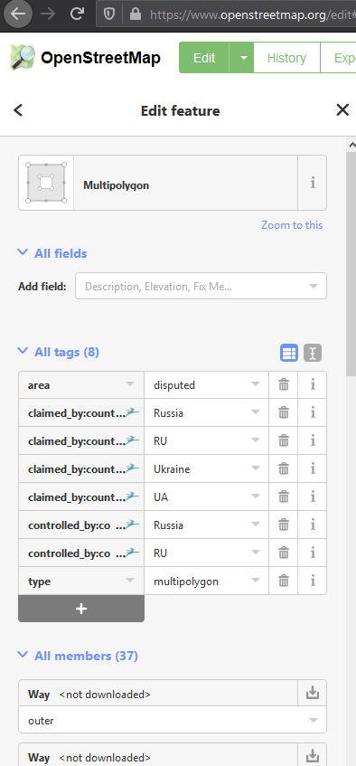
That seems accurate. However this is a separate object from the border which shows as the following:

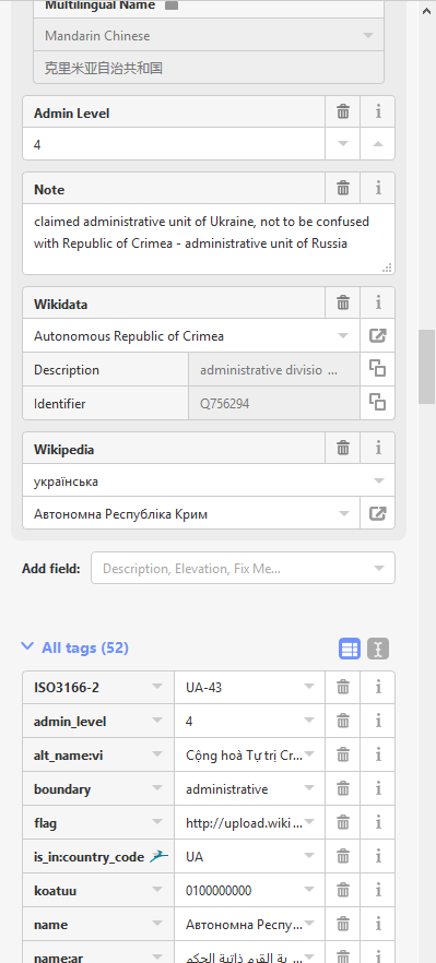
Then when clicking to view that Autonomous Republic of Crimea border that sometimes shows up, it has the following note:
When researching why it would show conflicting information, it appears that this is intentional: https://wiki.osmfoundation.org/wiki/Working_Group_Minutes/DWG_2014-06-05_Special_Crimea
In November of last year they attempted to remove Ukraine’s ties to Crimea but decided to maintain the existing Ukrainian disputed administrative boundaries with a statement: https://lists.openstreetmap.org/pipermail/osmf-talk/2019-February/005972.html
Anyways here’s some additional information on how OSM handles disputed territories: https://wiki.osmfoundation.org/w/images/d/d8/DisputedTerritoriesInformation.pdf
2 Likes